Editor's review
This is hydrographic survey tool.
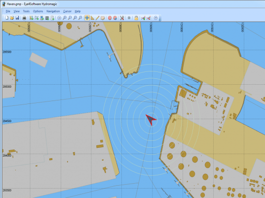
Eye4Software Hydromagic is hydrographic survey software for Windows. This helps you generate depth maps using a GPS or RTK receiver and an echo-sounder or fish-finder. This tool will help you generate the DTM or the digital terrain model of the bottom of the water body. Depth contour and cross-sections also could be created. This tool incorporates several methods of calculating volumes of basins, ponds, river sections and of lakes. Many of the popular CAD, GIS and nautical chart formats could be handled by this tool. It can read and create outputs in any of these formats desired. These standards include GeoTIFF, Microstation DGN, ARC/INFO, MapInfo MIF/MID, AutoCad DXF files, IHO S57/S63 Electronic Nautical Charts, Google Earth KML/KMZ files and ESRI shapefiles. This tool supports a range of map projections, some 5000 of them in all. NTv2, NADCON and HARN correction grids are supported.
Tide levels in real time can be calculated with a RTK receiver connected to the PC. Using the antenna height, antenna offset and a geoid model, the tide level is calculated and applied to the sounding. What you get are height values relative to the local vertical datum. If local maps are not readily available, you could use the built-in map downloading tool. OpenStreetMap, Google Maps or Bing maps can be used as background maps. The recent version enables collection of data through additional sensors such as a magnetometer, echo-sounder, etc. You could process dual frequency sounding data. With echo-sounders it is possible to collect reflectivity or bottom-loss data. Shorelines data can be added to adjust the data collected by specifying on which side of the shoreline water is. This is a very good tool.


User comments